- Index
- The Cinder Track
The Cinder Track
Coastal Trailway where you can choose your own start and finish points. The track surface is for the main cinder, making it ideal for both walkers and mountain bikers.


About The Cinder Track
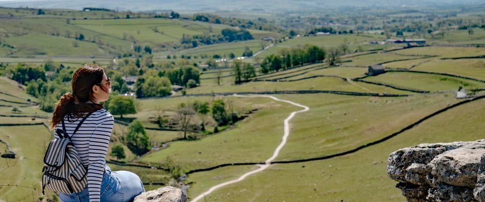
Once the Scarborough to Whitby Railway, now known as The Cinder Track. Following its closure in 1965, this picturesque 21.7 mile railway route has been a much loved off road pathway up and down the coast for walkers and cyclists to enjoy. It is Route 1 of the National Cycle Network and should not be ridden on thin road bike tyres.
You can start and finish at various points along the route with plenty of natural stopping spots for a rest on a bench with your flask and the view or at one the welcoming cafes.
Starting in Scarborough the track begins just underneath Wykeham Street bridge, behind Sainsbury's, off Falsgrave Road (YO12 5EA).
The track sets off north through a series of cuttings, passing under several bridges, into suburbia, before skirting alongside the playing fields, at the site of the former Northstead Carriage Sidings.
Next pass along Chichester Close, turning right onto Station Road, then left onto Field Close and right into Lancaster Way. At the end of Lancaster Way, pass through a gate back into open countryside.
After crossing a stream, the Trail soon crosses the busy A165 Coastal Road on the level at Burniston. There is a pelican crossing. After leaving Burniston, it's not far to Cloughton.
Leaving Cloughton, the Trail enters the North York Moors National Park, and starts to steadily climb.
With glimpses of the North Sea, the track passes the old platforms at Hayburn Wyke station, with the opportunity for refreshments at the Hayburn Wyke Hotel. If time allows perhaps make a diversion to walk down to the Wyke itself, a beautifully scenic cove belonging to the National Trust, with a double waterfall straight onto the beach.
Back on track, our path continues to Staintondale.
For those continuing northwards, the way continues to climb up to the highest point of the line, the former station at Ravenscar 631 feet above sea level. Ravenscar can be quite bleak and windy spot, but there is a Visitor Centre, a tearoom and the Raven Hall Hotel.
On leaving Ravenscar, pass through Station Square, along Station Road, and descend Peakside beside the National Trust Visitor Centre, the route then begins to descend through a large alum quarry, which was also the site of the brickworks, having a railway siding until the 1930s.
After the quarry, the route skirts heather-clad hillsides with magnificent views across Robin Hood's Bay. The descent continues through woodland, crossing several deep valleys on large embankments, before the site of Fyling Hall station is reached. A bridge has been removed, requiring a descent to the lane before climbing back up to track level.
The old station platform is easily missed amongst the trees, but the views soon return, as we pass Middlewood Farm caravan site. A further road crossing is required at Lingers Corner, before arriving at the former Robin Hood's Bay station. The station buildings have been converted into holiday accommodation, and the village's main car park has been built over the station yard. Various public houses and cafes can be found in this popular village, but be warned, the main street down to the rocky beach is VERY steep!
On leaving Robin Hood's Bay, the former trackbed has been covered by back gardens, so it is necessary to travel a short way along Station Road, before turning right into Mount Pleasant North, at the end of which the path is rejoined.
After descending all the way from Ravenscar, the path starts to climb again around Bay Ness. The clifftop route of the Cleveland Way can be seen beyond fields on the right-hand side. We swing away from the sea views once more and pass another campsite before crossing the main A171 road at Hawsker. Once again there is a pelican crossing, and the Hare & Hounds pub is a short way down the road. The station at Hawsker is now the headquarters of Trailways Cycle Hire, and features several railway carriages at the platform. There is also a small café.
After Hawsker, the line passes under the road to Stainsacre and then passes over the same road, before continuing into Larpool Woods, which lead all the way down to Larpool Viaduct on the outskirts of Whitby, crossing the River Esk and the Whitby to Middlesbrough railway line. The viaduct offers extensive views of the river and harbour, all the way across to Whitby Abbey.
The track passes between school playing fields before finishing abruptly at the top of Stakesby Vale. To continue into 'Whitby proper', one must continue down Southend Gardens, into Bagdale, which leads to the bus & rail stations, and the Tourist Information Centre.