- Index
- Lord Stones Walk
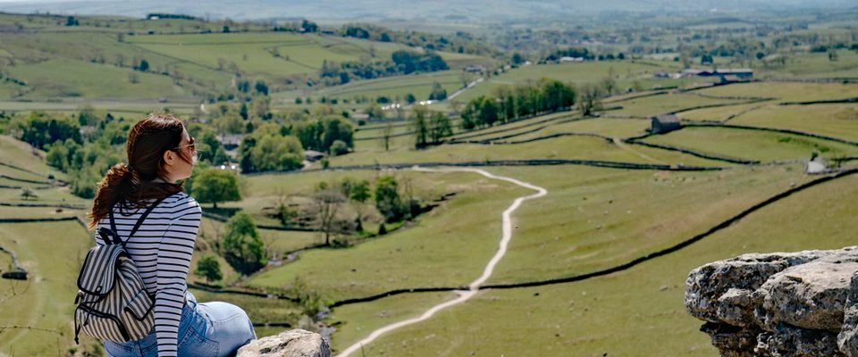
Lord Stones Walk
It might only be a shade under 3 miles, but this is a real adventure walk for all the family, with some awe-inspiring views into the bargain.


About Lord Stones Walk
It might only be a shade under 3 miles, but this is a real adventure walk for all the family, with some awe-inspiring views into the bargain. There’s a striking panorama of Middlesbrough, the Cleveland plain, Roseberry Topping and Cook’s Monument, which you’ll see both on the outward leg and then – after a stiff, stepped climb – on the return section that follows the Cleveland Way National Trail across Cringle Moor. The start of the trail is in the privately owned Lord Stones Country Park, where there’s access to the ancient stone that gives the walk its name – as well as parking, a café-restaurant and local produce shop.
Great for: big-sky views, family walks, list-tickers, rock-hounds
Length: 2¾ miles (4.4km) Time: 2 hours Start/Finish: Lord Stones Country Park Grid Ref: NZ 524 030 OS Map: Ordnance Survey OL26
Refreshments: Lord Stones Café Toilets: Start/Finish of the walk
About this walk
The going is good all the way round, on well-maintained paths with no stiles or gates en route. The only challenging section is the steep climb up the cliff edge to the top of the moor, but this is on a clear, stepped, stone path. Take care in wet or icy weather, as the path is exposed – adults should pay particular attention to any children in their party.
Dogs: Please keep your dog on a short, fixed lead at all times. There are severe drops from the stepped path and the moorland edge, so caution is advised.
Lords, stones and ancient ways
Lord Stones Country Park – owned by the Urra Estate – sits on land with an ancient pedigree, where a set of prehistoric stones forms part of a spectacular moorland panorama. The familiar local name – Lord Stones – tells a slightly misleading story, for although there are several stones here, the tale is actually of several lords and one significant stone, the so-called ‘Three Lords’ Stone’. The name is said to derive from three landowning lords whose estate boundaries met at this point on Carlton Bank. The stone itself is typical of the ancient waymarkers and boundary stones found across the North York Moors. It's marked with prehistoric carvings (cupmarks), and is one of a number of large kerbstones defining the perimeter of a Bronze Age burial mound – part of a small cemetery in a place where traditional boundaries, routes and meeting places have been established for many thousands of years. Indeed, before the nearby café was developed, the hillside used to be covered in numerous ‘hollow-ways’ – ancient routes worn down into deep, roughly parallel, trenches by the passage of countless of feet and hooves over the centuries.
Mining days
The landscape in this area has been dramatically affected by mining for jet – hard fossilised wood that can be intricately carved and polished to a soft sheen. The only place it’s found in the UK is in the North York Moors and Cleveland Hills, with significant deposits particularly along the coast near Whitby, which has been a centre for jet carving since Victorian times (although jet has been used for making ornaments since the Bronze Age). Large-scale mining only began in the 19th century when jet jewellery was all the fashion. Jet carvers from the Yorkshire coast appeared at the 1851 Great Exhibition in London, and the jewellery was popularly used during mourning following the death of Queen Victoria’s husband, Prince Albert. When the demand eventually died down after the 1870s, the industry here died here too, but you can still find the evidence. The word ‘Tips’ on the OS map denotes the presence of old spoil heaps below the now collapsed entrances to the mines. The undulating outward track on this walk runs over some of these.
Did you know? Jet is the fossilised wood of a Jurassic-era species of Araucaria, or monkey-puzzle tree.
Nearby businesses

Restaurant & Cafe at The Wainstones Hotel
Tucked at the foot of the breathtaking North Yorkshire Moors, our newly… Tucked at the foot of the breathtaking North Yorkshire Moors, our newly refurbished hotel is more than just a place to stay – it’s a destination.

The Wainstones Hotel
Whether you’re conquering the iconic Coast to Coast trail, chasing the… Whether you’re conquering the iconic Coast to Coast trail, chasing the horizon on two wheels, or simply soaking in the wild beauty of the…

The G&Tea House
Nestled between Great Ayton and Stokesley, The G&Tea House is the perfect… Nestled between Great Ayton and Stokesley, The G&Tea House is the perfect place to stop for delicious food and drinks in the North Yorkshire…

Angrove Country Park
Angrove Country Park is a hot tub holiday park located between the… Angrove Country Park is a hot tub holiday park located between the peaceful old market town of Stokesley and the beautiful traditional village of…